SuperMap Online
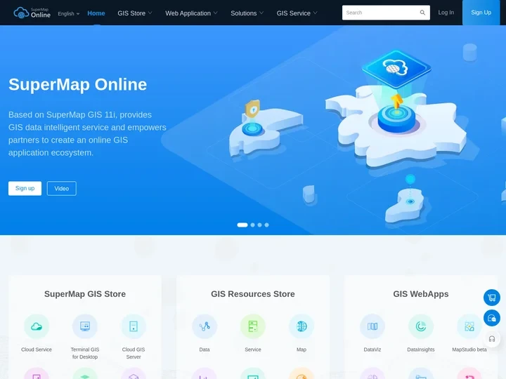
SuperMap Online is an online mapping platform that provides a wide range of geospatial data analysis and visualization tools. It allows users to create, manage, and analyze interactive maps and spatial data from various sources.
Features
SuperMap Online offers several key features that make it a powerful tool for geospatial data management and analysis. Here are some of its notable features:
Advanced Mapping Tools: The platform provides a comprehensive set of map creation and editing tools, including the ability to add layers, markers, and labels to maps. Users can customize the look and feel of their maps with various styles and themes.
Spatial Analysis: SuperMap Online enables users to perform spatial analysis on their data, such as calculating areas, distances, and patterns. It supports various algorithms for spatial analysis, including cluster analysis, heatmaps, and density analysis.
Data Integration: The platform supports integration with various data sources, including ESRI MapServer, GeoJSON, KML/KMZ, and WMS/WFS. Users can easily import and export their data in different formats.
Data Visualization: SuperMap Online provides a variety of visualization options for displaying spatial data. Users can create dynamic maps, charts, and tables based on their data.
Mobile Access: The platform offers mobile access to its features through a dedicated app for iOS and Android devices. This allows users to work remotely and collaborate with others on the go.
Security & Privacy: SuperMap Online ensures the security and privacy of user data by implementing robust security measures such as encryption, authentication, and access control mechanisms.
Support & Community: The platform offers extensive documentation, tutorials, and support resources to help users learn and get the most out of SuperMap Online. Additionally, it has a large community of users who can share their knowledge and experiences.
Overall, SuperMap Online is an essential tool for anyone working with geospatial data. Its comprehensive features and user-friendly interface make it a great choice for both individual users and organizations looking to manage and analyze their spatial data effectively.


